Rural Addressing
CVR introduced the Rural Addressing system in 2015. This standardized system identifies and locates rural properties based on standards set by Alberta Municipal Affairs and will be consistent with other rural municipalities across Alberta.
Rural Addresses have been assigned for all residences and separate commercial buildings. First and foremost, this new address will be used by the 911 system to more easily and quickly locate your property in the event of an emergency. It may also assist utility companies, couriers and visitors in finding your residence or business.
Step 1: Identifying Addresses
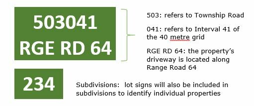
Rural addresses are based on the location of the PRIMARY access to a residence or business along a road allowance.
- Every mile is divided into 40 metre sections
- Those sections increase from South to North and from East to West
- Even numbers are along North and West sides
- Odd numbers are along South and East sides
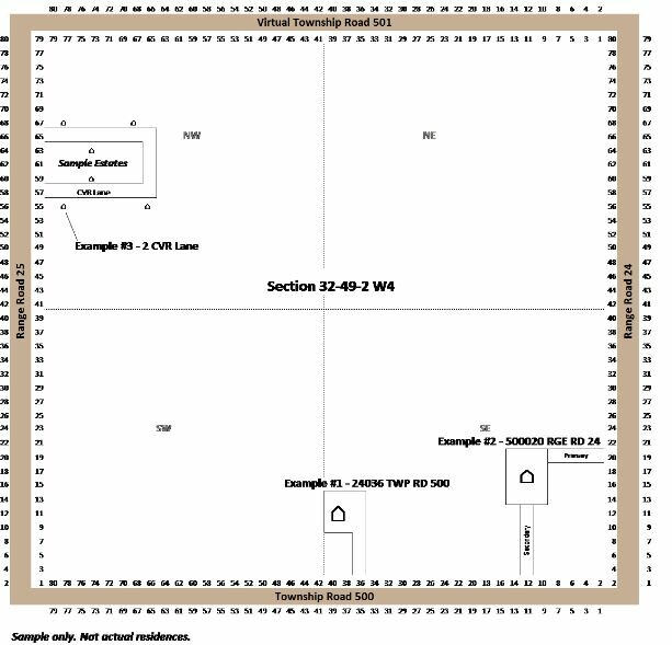
- If the Primary Access is off a Township Road, then you refer to the road to the east
- If the Primary Access is off a Range Road, then you refer to the road to the south
- There are virtual township roads between all sections, whether an actual road allowance exists or not